
Part 5 – Hadfield and Padfield
In 1066 Eilmer, who held Chunal, also held Hadfield. Like Chunal, Hadfield was on a major way, in this case the southern line of the saltway up Longdendale, which itself followed the Roman road from Melandra into Yorkshire.
The maps suggest that the original open arable field lay immediately west of the Old Hall, along the ridge either side of what later became Paradise Street. The name, Hetfelt in Domesday, is probably “heath field” suggesting that this windswept site, at 550 feet, was already grassland – no point cutting down trees if there was no need. Later, the village expanded south to what’s now “Sparrow Park”, where the saltway was joined by the ways from Glossop and Gamesley.
Along with neighbour Dinting, Hadfield was the smallest in area of all the villages south of the Etherow, and the common arable never seems to have extended much beyond the original field. Unlike Dinting, it had no satellite settlements; as the common was enclosed, the land continued to be farmed from the village centre, where four farms were still operating in the early 20th century. Higher and Lower Barn Farms were probably post-mediaeval, their names suggesting that they began as outlying barns used by farmers from the main village.
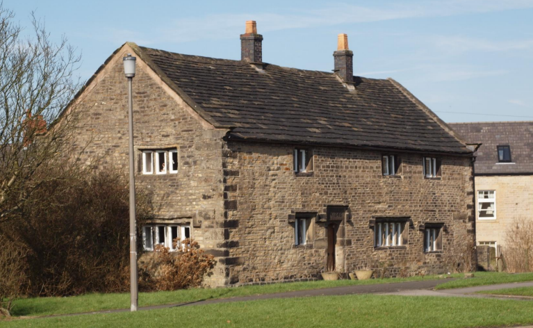
Despite its small size and lack of access to moorland commons, it would have profited from feeding travellers and their animals and was prosperous enough to support a substantial hall. The present building (see photo) is dated 1646, but its appearance suggests that it’s a re-skin of a single-storey mediaeval “hall house”, so Eilmer might well have lived on the same spot. Not in the same house, though – even if they weren’t razed by a marauding army, the early Anglo-Saxon houses would need regular rebuilds, although big oak timbers could be re-used again and again.
Padfield (Padefeld) next door also ran along a way, with the open fields either side, but the way, now the grandly-titled Padfield Main Road, went only onto the common, so no passing trade. At 750 feet it can’t have been a good place to grow cereals either, but nevertheless in 1066 it had the highest taxable value of all the villages, twice that of Glossop. This may have been because it was also the biggest in area, with common stretching seven miles up the Etherow valley to Saltersbrook. Much of the higher land is now covered in peat, but in the warmer climate it would have been grassland and much more useful as rough grazing.
Much of the common wasn’t enclosed till the late 18th century, but there were satellite settlements on the lower ground along the river – Deepclough and possibly Torside, and Old House was called that on Burdett’s map in 1767 so is likely at its core to be several centuries older. Herdsmen must also have lived high up the valley at least in summer. Windy Harbour was an early satellite on the common, on the boundary with Glossop, but Little Padfield, which sits on the edge of the open fields, was probably just mediaeval overspill from the main settlement, which was hemmed in on all sides by the fields.
Next week we will go across the river from Padfield, to villages which had once been in the same Anglo-Saxon lordship but which by 1066 were part of Cheshire.
NEXT – Part 6 Tintwistle, Arnfield and Crowden
PREVIOUS – Part 4 Dinting, Chisworth and Chunal