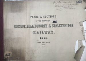
In 1866 Thomas Bouch, who would later design and build the first Tay Railway Bridge (and was subsequently blamed for its collapse), published plans for the building of a railway between Glossop and Stalybridge running via Hollingworth, Mottram and Matley. The plans were deposited with the Clerk of the Peace for Cheshire on 29th November 1866.
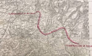
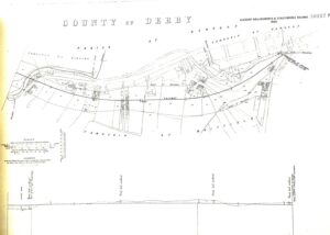
The railway would have started at the northern edge of Stalybridge, swung round to the east of St Paul’s Church before running south to Matley and turning eastwards to run to the south of Cheethams. It would then have run more or less parallel to the road through Mottram and Hollingworth (running to the north of Wedneshough Green) before turning south east at Millbrook and running to the east of Etherow House, Wooley Bridge and Brookfield. The route would have continued between Shaw and Dinting Vale, passing just to the north east of the Junction and Pikes Farm and to the south of Shepley Mill with the terminus by Victoria Bridge and the Albion (now Last Orders) public house.
The supposed reason behind the plan is that it would provide a close rail link to serve all the Cotton mills (including the Staly and Hollingworth ones) right up to the Howardtown complex. At the time the Cotton Famine had recently finished and it would have been a way of speeding up the import of raw cotton and the export of finished goods.
The reason why it was never built requires more research. It is possible that the landowners who would have been affected were against it or there wasn’t enough investment money to provide for the costs of a route which would have faced some steep gradients.
Around 8 years later powers were obtained to build the Waterside Branch which served the Hadfield mills and Dinting Printworks, thus providing the required rail link by alternative means.
The images below are of the cover of the filed design, the OS map of the route and the map of the run into Glossop with the terminus by Victoria Bridge and the Albion (now Last Orders) public house.
They are reproduced by permission of Cheshire Archives and Local Studies which holds the full plans under the reference QDP/469.