
After the Romans, the first road builders locally were the monks of Basingwerk Abbey, which held the Manor of Glossop till 1433. They didn’t, though, build Monks’ Road, which is a late 18th-century “enclosure road”; the earlier, unsurfaced, way can be seen alongside. Mention of a “cauce” or paved way in a 13th century document probably refers to the Buxton-Melandra Roman road, which wasn’t rediscovered till 1971; the Abbot’s Chair, the base of a wayside cross, sits on a bend in it.
What they did build was a road between their main bases at Charlesworth and (Old) Glossop which was surfaced at least in some places, but that was a rare exception to the usual ruts and mud. In 1555 a despairing Tudor government ordered the parishes to maintain their ways.
It didn’t achieve much. The locals already looked after their own lanes, but why spend time and money repairing highways over the moors used mainly by outsiders? It took another 200 years to find a solution.
In the meantime the big landowners funded piecemeal improvements, and in Longdendale and Glossopdale there are many examples. In 1683 Besthill Bridge in Charlesworth replaced a ford upstream, and Back Lane probably dates from the same period. Travellers going north into Yorkshire were also diverted round (Old) Glossop by a road, now Gladstone Street, from Whitfield Cross to a bridge at Bridge End (where Wetherspoons now is).
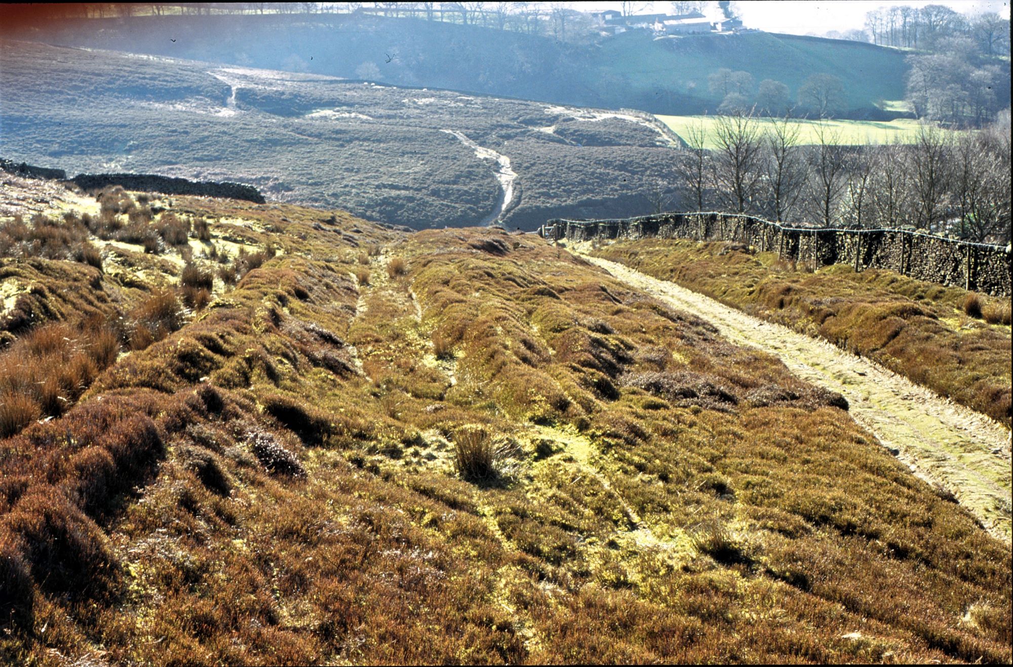
The old way from Mottram to Tintwistle was also replaced by a road running down Mottram Moor and over a bridge at Millbrook, and there was, via a bridge at Woolley, a link to (Old) Glossop which can still be seen running across the fields west of Top O’Th’Hill. Existing ways were also improved by widening and surfacing one of the holloways, as at Tom Heys where the way from Edale and Chapel, still visible (see pic), was about 90 feet wide.
In 1691, parishes were ordered to make highways to markets wide enough for a cart. However, the routes over the high moors were still a struggle for wheeled vehicles, and the most the landowners could do was to help walkers, riders and packhorse trains stay out of the deep mud churned up by carts and waggons. In 1703 Reginald Bretland, a lawyer whose family owned land in upper Longdendale, left £30 (about £6k today) to build a paved pathway or “causeway” from Hollins to Saltersbrook. A section can still be seen east of Woodhead Chapel. Doctor’s Gate can only ever have been a packhorse way, but the paved summit section, generally thought to be mediaeval, may also date from this period.
These efforts, though, weren’t enough. The traffic got heavier, and ways surfaced by parish surveyors, usually unpaid and reluctant amateurs, quickly broke up. Even if they didn’t, they were often too steep for heavy carts – at Tom Heys the maximum gradient was 1 in 5. A more radical approach was needed, shifting the cost to those who would benefit most, and when it came, Longdendale was in the forefront.
Next – Part 5 – A Thin Winding Ribbon of Gravel
Previous – Part 3 – The Salt of the Earth