
By the late 1790s it was easy to get from (Old) Glossop to Manchester on good roads, but the turnpiked route to Stockport was through Mottram and Gee Cross. It isn’t surprising, therefore, that in 1803 there was an application for an Act to turnpike the route to Marple Bridge, which from Charlesworth was just a series of lanes from farm to farm, used mainly by farmers and coal carters and probably very muddy.
The quickest way to Charlesworth was the one used by the mediaeval monks, via Littlemoor, Bridgefield, Old Lane Simmondley and High Lane, but the new road didn’t go that way. Instead it went an extra half-mile round, via Dinting Vale, then up a steep hill, and no sooner had it been built than the Howard estate “stopped up” Old Lane (then How Lane). Simmondley Lane was built to replace it, but with a tollbar at the bottom.
Why? Well, this was a road on the estate’s land, and built to serve its interests, and its first interest was in opening up the valley bottoms for mill developments and giving the mills the best possible access to Manchester. The branches to Charlestown along Long Clough, now Primrose Lane/Turnlee Road, and to Woolley Bridge through Brookfield were therefore as important as the main line.
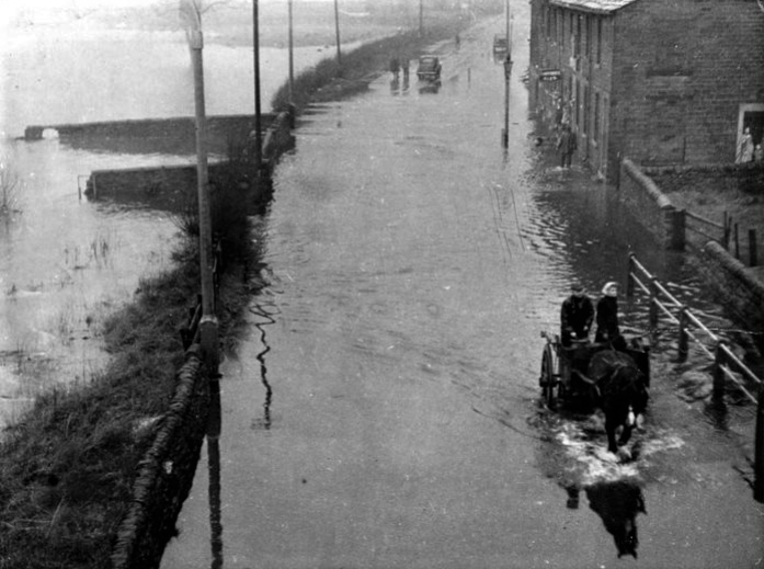
In their natural state the valley floors were notoriously boggy and flood-prone, so these branch roads were possible only because the estate had already lowered and straightened the streams. Even so they were pushing their luck, as evidenced by frequent floods ever since (see pic, Spring Tavern 1948). Within 20 years, though, there were nine more mills along Long Clough and Glossop Brook, plus another nine along the road through Charlesworth and Chisworth.
Whether the second consequence was part of a grand design is harder to say. As first built each mill was a self-contained community with its own cottages, but it didn’t stay that way. Just north of Bridge End, where there was already a mill, the new turnpike crossed the Chapel-Enterclough road turnpiked 10 years earlier. One of the trustees, John Wagstaffe, saw a business opportunity and leased land in the angle between on which to build a pub, the Howard Arms; in 1819 rising entrepreneur John Wood bought the mill; and within a few years Howardtown began to form, initially as a long line of cottages along the turnpike from The Junction to Milltown with the crossroads as its centre.
Almost certainly, though, the Howard estate did have another long-term plan. The Manchester – Sheffield route via Winnats Pass and Castleton being indirect, a new road via Glossop, reinstating the old packhorse route, Doctor’s Gate, had been under discussion since 1772. It may seem odd that, as you drive along High Street East, the former turnpike to (Old) Glossop appears to be heading for the hills, then suddenly turns through nearly 90 degrees up Manor Park Road. Why didn’t it go more directly, across what was then still farmland? Because the Howards were planning to head for the hills…..
Next – Part 9 – A Road Too Far
Previous – Part 7 – The Road That (Almost) Never Was